At September 24 – Brief: shishalh Nation – B.C. Joint Land Use Plan
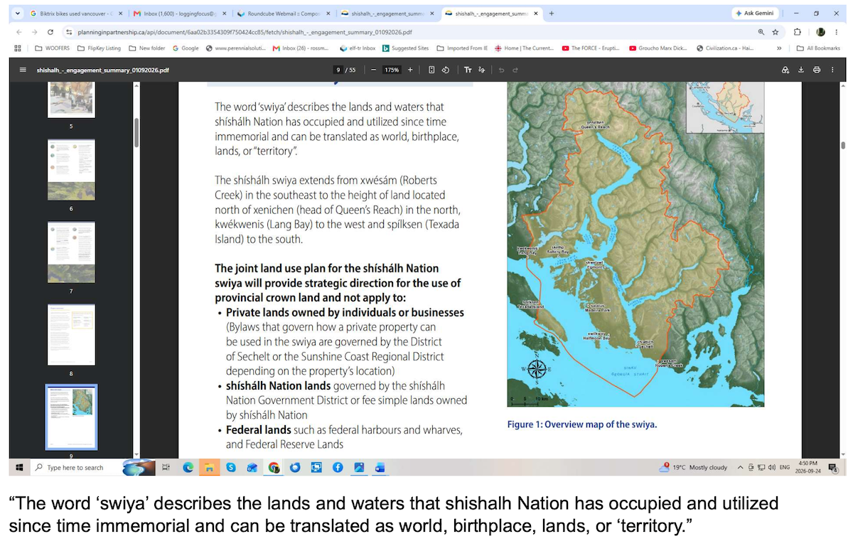
Highlights of the “Engagement Summary” (Phase 2 published July 2026) from this Sunshine Coast regional land use plan has been released. Link to the full report found at end of this document.
Of interest is that the “Elphinstone Forest” is seen in the land use plan with “Medium Frequency” ranking and as a “Point of Location”. We read this planning terminology to mean that the Elphinstone Forest area will be given a priority to be considered a conservation area due to being of importance to all participants who submitted comments. What this means for future legal protection as an expanded provincial park or Indigenous Protection Conservation Area (IPCA) is unknown, however in Phase 3 of the land use plan, that will become clear with another opportunity for public input.
Adjacent Elphinstone Forest “Point of Location” is the Wilson Watershed + estuary being assigned a “Medium Frequency” of interest for future management. read more
At September 23 – Critique: SCCF’s Proposal to Expand its Logging Tenure
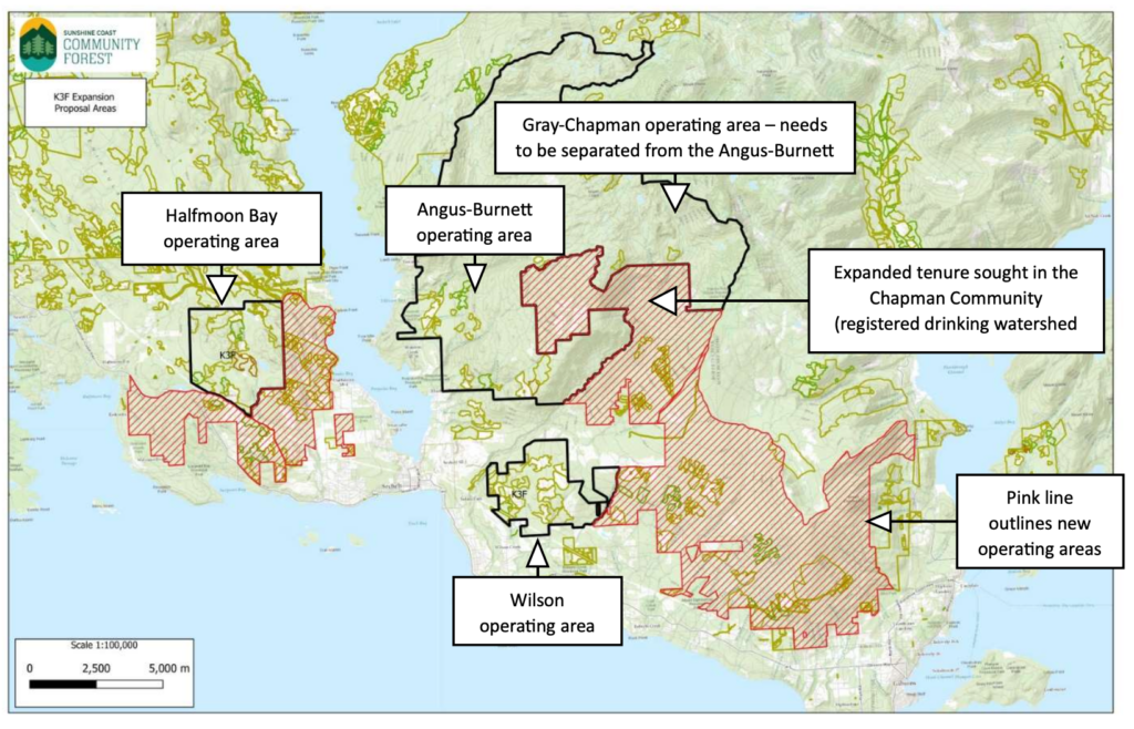 In an August 2026 newsletter, entitled “Growing the Community Forest”, The Sunshine Coast Community Forest (SCCF) a logging company 100% owned by The District of Sechelt, announced aspirations to acquire a larger Timber Harvesting Land Base (THLB) beyond their three active operating areas of Halfmoon Bay, Angus-Burnett and Wilson. This announcement came on the heels of SCCF purchasing forest license A86929 (from Interfor) providing an extra 12,000 m3 volume of timber.
An accompanying map SCCF presented showing an expanded tenure they’re seeking includes contentious areas, including the Mt. Elphinstone Provincial Park expansion initiative, additional sections of the Chapman Creek (registered) Community Drinking Watershed, District Lot 1313 in Gibsons, including The Reed Rd Forest, and forests surrounding the Sargent Bay Provincial Park. read more
At July 29 – The Langdale Creek Watershed Requires Full Protection
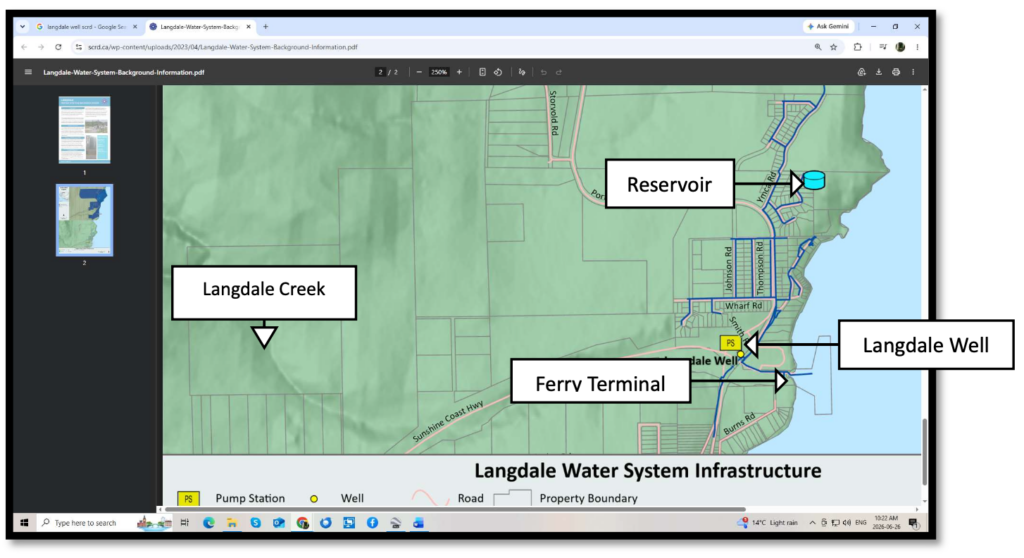 The Ministry of Forests’ independent BC Timber Sales (BCTS) has posted cutblock (Blk) TA2535 onto a Sales Schedule for the July 1 – September 30, 2026 period in preparation for logging contractors to bid on this timber sale. Area to be logged is 35ha and at this time BCTS has not shared the Site Plan revealing details such as road location, riparian set-backs, level of block tree retention, however, a GIS analysis of the block has been completed by Applied Conservation GIS (retained by ELF-Trails & Research).
“We recently hiked up the K2 trail and stumbled upon a woodlot logging operation (Ken Sneddon) high on a slope above Howe Sound noting how a new logging road extended further up the mountain, then realized that this is the most likely route BCTS would use to gain access higher up to Blk TA 2535.” Ross Muirhead of ELF notes, “This BCTS block on steep slopes is one of the most outrageous blocks we’ve come across in decades and has to be canceled due to the many post-logging risks in the Langdale Watershed.” read more
At July 29 – BCTS’ protocols for managing At-Risk Ecological Communities
 FPPR s. 69 “an authorized person who carries out primary forest activities on an area must comply with each general wildlife measure and general ecological community measure that applies to the area.”
Hello BCTS HQ Staff,
Our organization is asking the following questions regarding At-risk ecological communities (AREC) at BCTS’ Blks TA0545 (Secret Cove, Sunshine Coast) & TA2535 (Langdale Creek, Sunshine Coast) on BCTS-Chinook’s sales schedule July 1 – September 30, 2026.
- Has BCTS-Chinook staff completed a Natural Disturbance Type (NDT) assessment for Blks TA0545 and TA2535?
- What steps were taken to confirm At-Risk Ecological Communities (AREC) in the two blocks?
- Is BCTS aware that structural age of 6 (Age Class) to 7 are considered mature to old and these stands meet that age criteria that supports ARECs?
- Did BCTS Staff complete “Operability observations” and charts for the AREC’s found in the two blocks?
- If BCTS identified AREC’s in the two blocks, how is BCTS managing them at the stand and landscape level? read more
At June 7 – Summary of GIS analysis Cape Mudge blocks
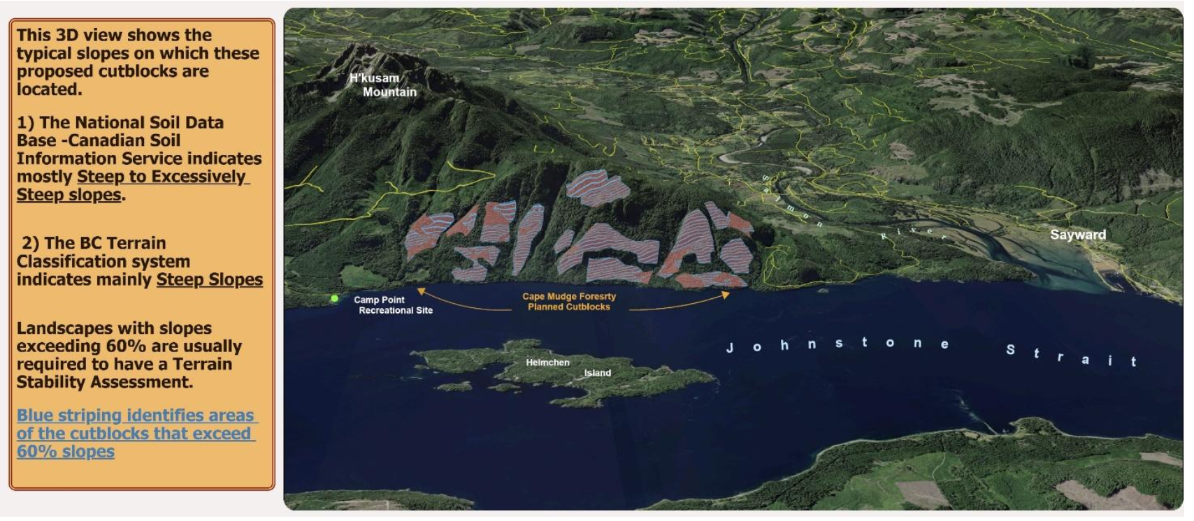
Note the following introduction is an AI generated account.
The “Cape Mudge old-growth blocks” refer to a controversial 13-cutblock timber harvesting proposal targeting an intact old-growth temperate rainforest on the eastern coast of Vancouver Island. While the query connects this to the Wei Wai Kum First Nation, the logging company involved (Cape Mudge Forestry) is actually wholly owned and operated by their sister nation, the We Wai Kai Nation.
The Location and Cutblocks
- The Area: The proposed logging footprint sits just east of Sayward, B.C., within the Prince of Wales mountain range near Mount H’Kusam.
- Significance: Conservation groups and community advocates highlight this area as potentially the largest remaining intact, unprotected old-growth forest on the eastern coast of Vancouver Island. It features massive ancient trees, including species like yellow cedar and Douglas fir.
- Harvesting Style: Because of the steep, rugged mountain terrain, the proposed operations involve specialized helicopter logging (heli-logging). read more
At May 28 – Summary to the Roberts Creek Watershed web map
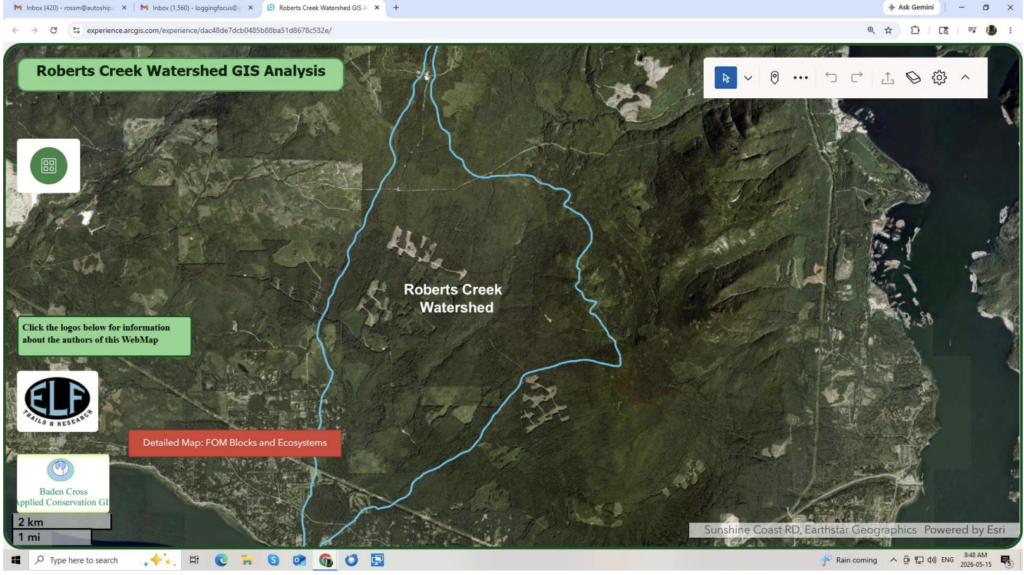
The following screen captures and comments provide an interpretation to several of the map’s layers. BCTS blocks planned in this watershed are TA0520 and A94817. Past logging in subdrainage (Clack Creek) included Blk TA0021 and A93884. read more
April 23 – BC Timber Sales’ Old Growth Disruption is Unconscionable
“Purposely causing extinction is not just a moral failure, but also a high economic, ecological and social risk.” Rachel Holt, Karen Price, Dave Daust, Gerry Merkel, Lisa Matthaus (former members of the provincial government’s Old Growth Technical Review Panel)
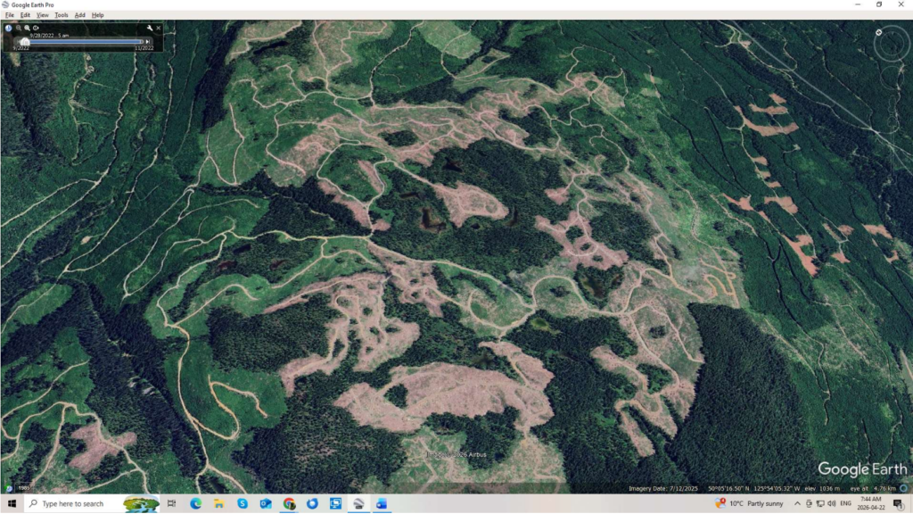
“A scan of public B.C. government mapping shows about half a dozen proposed B.C. Timber Sales cut blocks overlapping with ancient and big-treed forests on the slopes around Nahmint Lake, southwest of Port Alberni, B.C., with more in the surrounding area. Overlap between proposed cut blocks and old-growth mapped by the advisory panel can also be seen in the Tsitika area of northeastern Vancouver Island. A message to users opening the mapping website says the proposed harvest areas may require additional planning activities and consultation with First Nations and other stakeholders, and may be subject to change.”
From: https://www.cbc.ca/news/canada/british-columbia/old-growth-forests-bc-failing-to-save-9.7128469
A recently released BC Timber Sales (BCTS) referral map listed 9 (nine) old-growth cutblocks at different stages of planning in four regions of Vancouver Island. These blocks are set to be sold and logged anytime 2026-2027. The level of public review of these blocks has been severely restricted BCTS planners uploading block polygons to the government Forest Operations Map (FOM). The Ministry of Forests (MoF) expects the public to provide meaningful comment on forestry planning however this low level of public engagement is clearly a failure. read more
At April 17 – Old Homesite Creek Forest pulled from logging
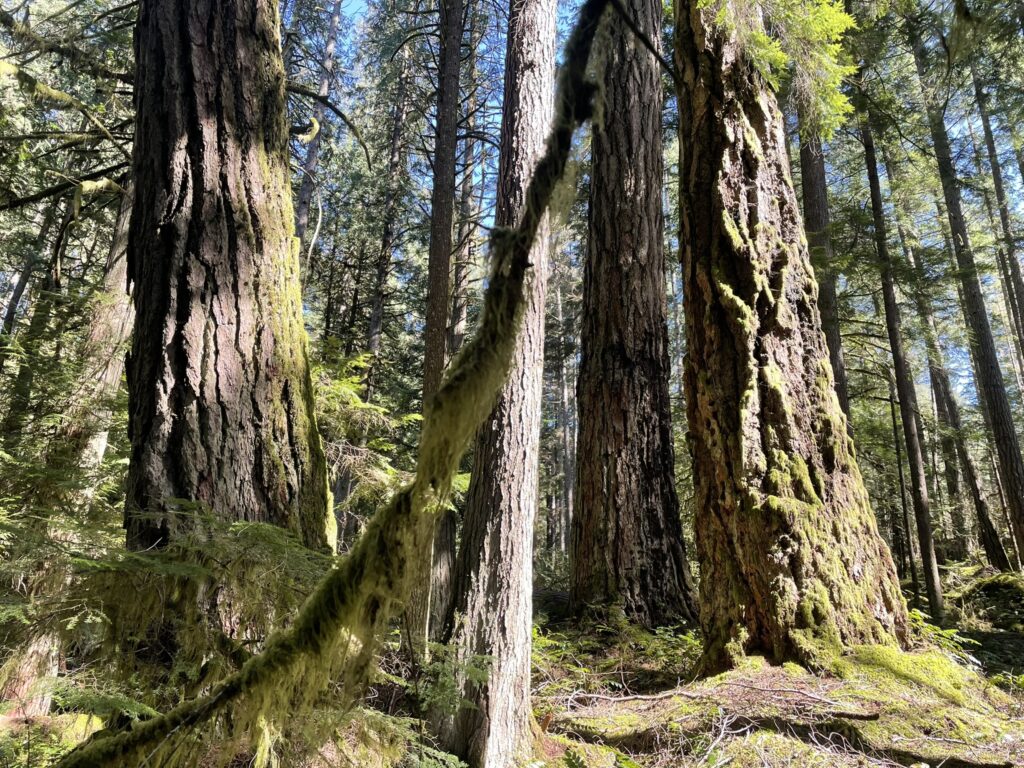 A BC Timber Sales (BCTS) cut block TA536 found on a BCTS 5-year plan has been apparently removed and all indications point towards that this critical forest ecosystem will be saved from industrial logging & roadbuilding. The most recent BCTS 2026-2029 block referral portal did not have the TA536 appear, in other words was removed or “pulled.” The whole block contains red and blue forest ecosystems which was not revealed by BCTS during the initial referral period.
TA536 was not engineered in the field (flagging marking out falling corners or road centre line), however BCTS had developed a site plan that was revealed in the old referral portal sent to official stakeholders, like the Sunshine Coast regional District and the Sechelt Indian Band. The forest that timber cruisers were targeting was an old-growth Douglas-fir, mature red cedar in a well-established plant community. Homesite Creek runs below the block and is dependent on the intact forest cover to manage its low and high flows. read more
At March 25 – Case for adding more OGMAs to the Sechelt Landscape Unit
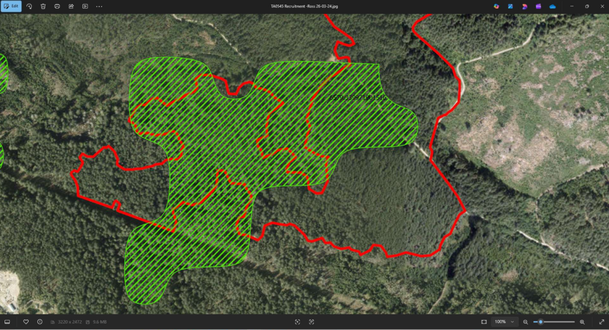 This report addresses a concern that BC Timber Sales-Chinook is moving ahead with several blocks in the Sechelt Landscape Unit (LU) containing older forests (Age Class 6-8) which reduces the amount of mature – old forests that could be added as Old Growth Management Areas (OGMA) to support tomorrow’s old-growth. In addition, there are several processes underway in this Sunshine Coast Forest District, such as the shishalh-Victoria Modern Land Use Plan and the Sunshine Coast Forest Landscape Planning (pilot) which will change the direction of how forestry is done in this region. Meanwhile, BCTS is moving ahead on blocks in this Sechelt LU in apparent denial of new directions and the science of how to ensure that biodiversity does meet the fate of “irreversible loss” – a planner’s professional nightmare. read more
At March 17 – Save The Cedar Knowledge Forest
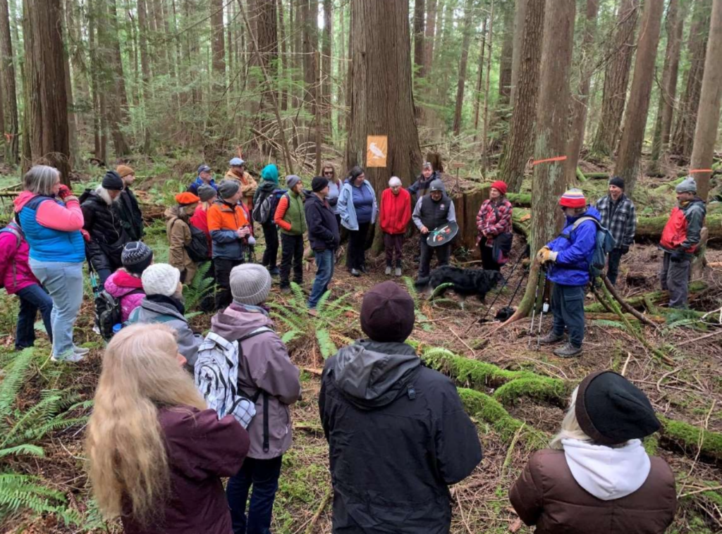 A guided walk on March 15th into a proposed Sunshine Coast Community Forest (SCCF) Blk EW25 was completed with 30+ community members attended by shishalh knowledge-keeper hiwus Calvin Craigan.
The group followed a new recreational trail that meanders through the block eventually reaching a mossy bluff with evidence of elk usage. A short way into the interior of this forest their attention was held by this former 2x elected chief of the shishalh Nation drum and then speak under this stand of red cedar – sword fern. Participants had questions on why this forest was chosen by SCCF to log, and were given a postcard allowing them to put into their own words their experience of this forest located on public lands within the context of the shishalh swiya. read more
At February 23 – Talk & Log and the shishalh-Victoria MLUP
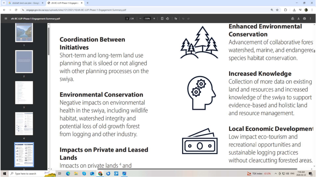 This report is meant for land use planners, including those at BC Timber Sales, Sunshine Coast Community Forest, staff at shishalh Rights & Title and the provincial government’s Water, Lands, Natural Resources and the local MLA to read and consider.
It’s meant to reveal an institutional problem with the Modern Land Use Plans (MLUP) and ongoing permitting by the Ministry of Forests to logging tenure holders to log out the very resource (the forests) with its multiple values that is under discussion between the shishalh Nation and province of B.C. read more
At February 17 – Do not undercut the xwesam (Roberts Creek) Watershed
 Stacey Gould, RPF
Timber Sales Manager
BC Timber Sales, Chinook Business Area
Chilliwack, B.C.
Dear Ms. Gould,
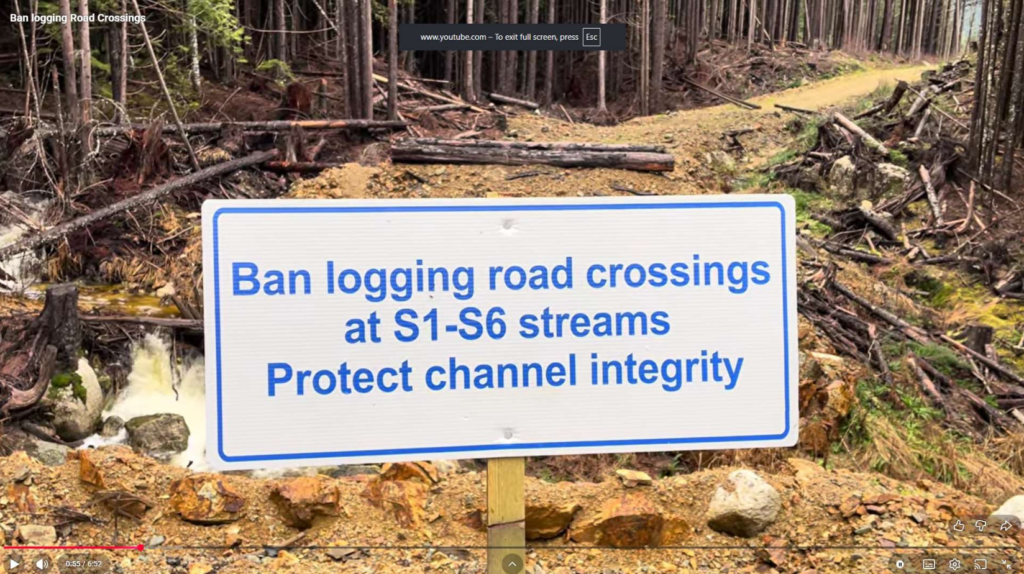
Our organisation has serious concerns regarding BCTS’s Blks A94817 & TA520 located in the upper xwesam (Roberts Creek) Watershed and in this brief will provide an adequate defence for its full protection in light of this ill-advised plan.
The proposed timber sale is a 2nd growth stand situated on a slope right above xwesam (Roberts Creek) meaning that all drainage off this slope reaches this channel. The forest being targeted is in the recovery phase due to past wholesale loss of the original old-growth red-cedar. This former climax forest once secured the slope’s stability, hydrology, vegetation, habitat and biodiversity. It probably could do with 80-100 more
years to fully recover. read more
At February 3 – Human-caused fires: a threat to regional infrastructure, including water
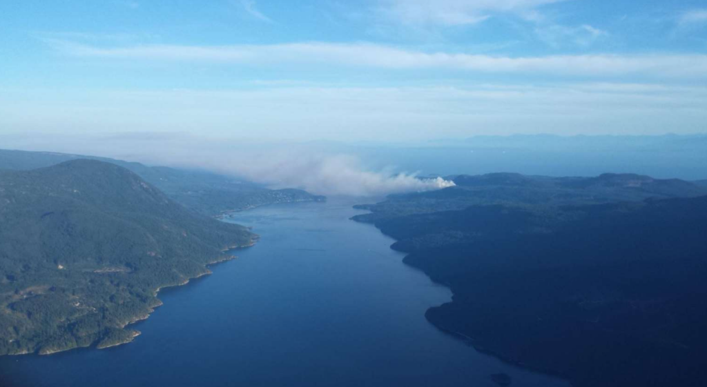 Across the Sunshine Coast Region an ongoing issue of open access to the backcountry along spur roads constructed by both forestry to reach cutblocks, spur roads to BC Hydro corridors and to Fortis gas line remain open posing a risk to regional infrastructure. These spur roads (intersecting off the main forest service roads) allow anyone with a pick-up truck or sedan to enter them and take advantage of this open access to engage in illegal dumping, firearm discharging, target shooting, campfires, and disposal of large items, such as RVs and old cars. In a number of cases, people set their trash on fire to erase tracing items back to them. read more
At January 31 – Comments to SCCF’s 2025 Operating Plan (Block Analysis)
 This is a revised version of the document sent to SCCF on 2026-01-30. It clarifies the use of the provincial government’s Conservation Data Centre’s (CDC) at-risk ecosystem mapping applied to proposed SCCF blocks and the importance of the Age Class being an influencing factor in terms of a stand becoming well-established. An analysis of Blk EW16 has been added.
Applied Conservation GIS (ACGIS) used the CDC at-risk ecosystem dataset and identified areas where SCCF’s cutblock overlapped each biogeoclimatic subzone variant. This is a “coarse-layer” approach, a useful starting point to better understanding forest conditions at the block level. Then, ACGIS added the Age Class (AC) for each block. Each of the above layers were separated out by polygons where changes were noted. read more
At January 20 – Halt BCTS’ feller-bunchers entering the Aquifer Recharge Zone
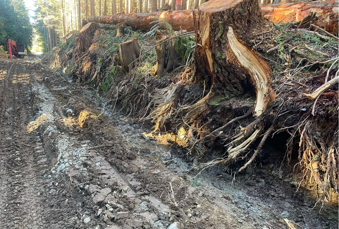
Based on the importance of ground-water recharge functions for the Town of Gibson’s Aquiferour organization is calling on BC Timber Sales (BCTS) to restrict timber extraction to the current heli-logging operation. Essential to a well-functioning aquifer is having a protected and intact Recharge Zone. Unfortunately, BCTS planned Blk TA519 is within the town’s Aquifer Recharge Zone (ARZ) located in the Chaster Creek Watershed, Mt. Elphinstone slopes. The findings from this report conclude that any further tree removal at BCTS’ Block TA519 should be restricted to heli-logging to mitigate damages to Gibson’s ARZ.
Allowing feller-buncher(s) to proceed into the block will no doubt increase the disturbance of the hydrology. The cumulative-effect of more trees being lost, heavy machinery (feller-bunchers) cutting in the stand, its impacts on ephemeral water flows and soil will result in significant hydrological impacts. BCTS has disregarded that the block is within a community’s ARZ and
therefore block planning and reporting does the meet the test of professionalism. read more
At January 7 – Re: Save The Cedar Knowledge Forest
 Ms. Isabele Houde, RPBio
Environmental Policy Advisor
shishalh Nation Rights & Title Dept.
Sechelt B.C.
Dear Ms. Houde,
The Sunshine Coast Community Forest (SCCF) of Sechelt, B.C. has laid out a cutblock EW25 in a forest within the shishalh swiya which our organization would like to bring to your department’s attention as it has significant regional importance on several levels within the context of the current shishalh-Victoria land use planning process that your office is engaged on.
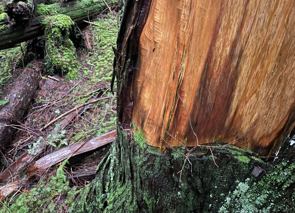
The area, which we have named The Cedar Knowledge Forest (a name carefully chosen which should become apparent) underwent a GIS analysis and is proves to have both Red & Blue listed ecosystems within a well-established plant community, is adjacent to an Old Growth Management Area (OGMA) that could be expanded to include extensive cedar bark harvesting by shishalh First Nation member(s). Identified as Blk EW25, it’s in SCCF’s referral stage, with a projected logging date sometime in 2027.] read more